With its intentions to launch a network of satellites to map heat signatures throughout the earth, Satellite Vu is generating a lot of attention.
These observations have been made for a long time, but not with the frequency and resolution (3–4 m) that the London firm says.
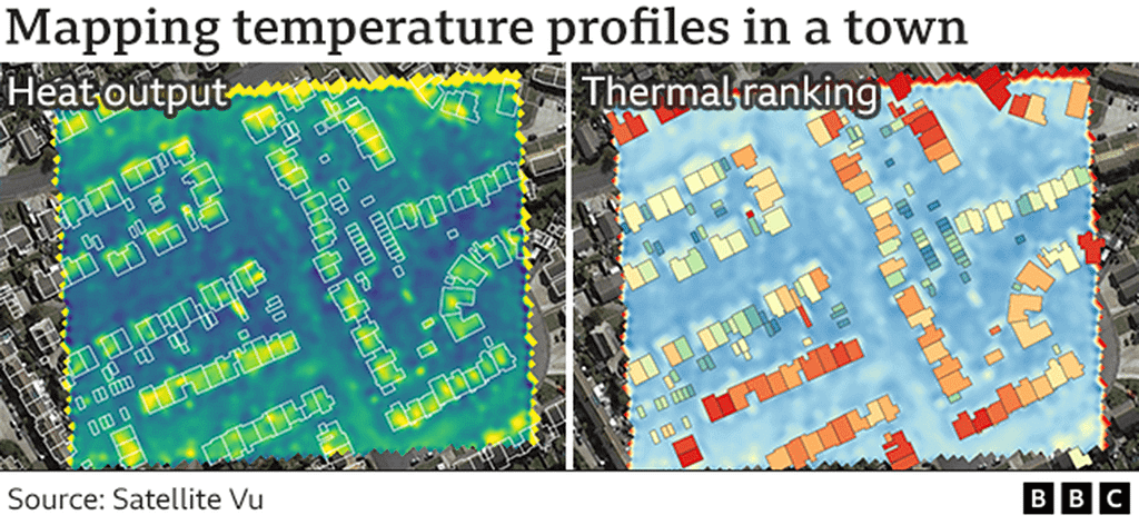
As a result, Satellite Vu will be able to map the temperature profiles of specific workplaces, offices, and factories.
The new thermal data-sets can tell you where in a city the most inefficient housing stock is, where energy is being squandered, and where you should focus your insulation spending.
The knowledge might significantly aid the nation in fulfilling its net-zero commitments.
One is currently being constructed by Guildford firm Surrey Satellite Technology Limited (SSTL). By the end of 2025, a second will take Satellite Vu one-quarter of the way toward an eventual eight-platform constellation in the sky.
At mid-wave infrared wavelengths, the spacecraft will be able to detect the ground (3.7-4.95 microns). That light is too bright for most Earth observation satellites and for human vision, yet that is the area where structures’ retained heat energy will be visible.
“With infrared, what you see in daytime, you can see at night. And whereas most other Earth observation data-sets are looking at the outside of buildings, we can even get an inference of what’s going on inside – whether there’s activity in that building, whether a house is occupied, whether there’s productive machinery in a factory,” said Anthony Baker, CEO and co-founder of Satellite Vu.
The company has so far raised £20 million in funding. To test data processing techniques and show potential clients what is possible, a version of its satellite sensor has been flown on an aircraft.
The possibilities are endless, and Satellite Vu is collaborating with UK universities and hosting hackathons to come up with new methods to make use of the data.
The satellites will swiftly locate the buildings and open areas that worsen the urban heat island effect in addition to detailing the heat profiles of the buildings. These include the sizable parking lots at shopping malls, which raise the temperature in towns and cities. The optimal places to plant trees to cool the environment would become clear to planners.
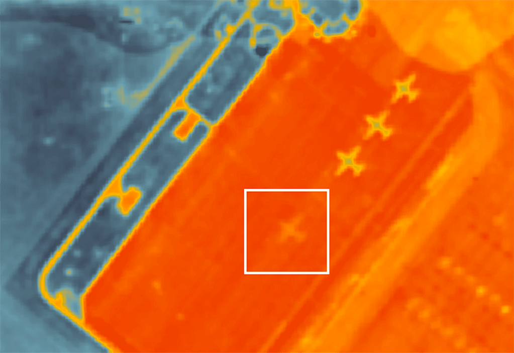
By showing how temperatures have changed in a location, the data will also be able to provide intelligence to the financial and insurance industries, as well as the military. For example, the cool “ghost images” that planes leave behind after having earlier darkened the ground from the Sun can be used to determine when they have just left an airfield.
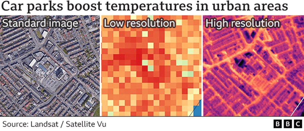
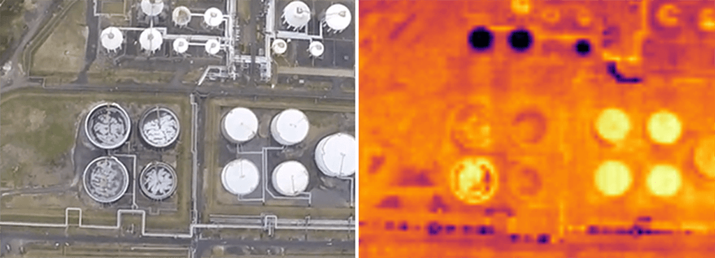
The image captured by a typical optical satellite is shown on the left. The currently publicly available resolution is in the center. The simulated resolution that Satellite Vu’s network should achieve is shown on the right. It is instantly apparent that local roads and the asphalt in the large parking lot are producing heat (yellow color).
“This kind of data-set has not been available commercially before, not at this resolution,” said Andrew Cawthorne, the director of Earth observation at SSTL.
“Who’d have thought you could monitor the ocean for plastic pollution, but in the infrared you can. These ‘islands of plastic’ you hear about will show up as hotspots.”
Satellite Vu chief technology officer and co-founder, Tobias Reinicke, reckons one of the company’s key applications will be in checking the efficiency of the giant solar farms now springing up around the UK.
“The hotter the solar panels are, the more problems they’ve got. Drones will obviously be used to see failures on centimetre-scales, but that’s quite expensive. We can routinely monitor the farms to detect failures in long strings of panels,” he told BBC News.
The UK Space Agency (UKSA) recently gave a grant to Satellite Vu to help with the development of the infrared sensor.
“Earth observation is a really interesting commercialising sector. There are some great companies out there, and whether they are headquartered in the UK or not, they all want to work in the UK,” said UKSA CEO Paul Bate.
Satellite Vu will launch its first satellite early next year.